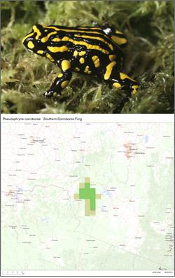
The Australian Government Department of the Environment has released more than 1,700 new maps and datasets that local communities can use to find threatened species in their area. The maps show known and predicted distribution of listed species, including areas …

Species of National Environmental Significance maps released Read more »

The Australian Bureau of Statistics (ABS) has released the first issue of Australian Environmental-Economic Accounts (AEEA). It brings all ABS environmental accounts together in one place to deliver a broad and cohesive picture of the environmental stocks and flows of …

Australian Environmental-Economic Accounts, 2014 Read more »

In the Global Forest Change study, Earth observation satellite data were used to map global forest loss (2.3 million square kilometers) and gain (0.8 million square kilometers) from 2000 to 2012 at a spatial resolution of 30 meters. Read the …

High-Resolution Global Maps of 21st-Century Forest Cover Change Read more »

The US National Oceanic and Atmospheric Administration (NOAA) has unveiled the beta version of “NOAA View”, an online educational tool that gives educators and the public interactive access to NOAA environmental data, enabling unique views of the world’s oceans, land, …

NOAA internet tool provides unique access to environmental data Read more »